If you are trying to make sense of natural resource management in Africa, start here. It means caring for land, water, forests and soils so people can live from them without using them up.
| Item | Value |
|---|---|
| Africa’s annual net forest loss, 2010-2020 | 3.9 million hectares per year |
| Africa’s share of the world’s forest area | 16 percent |
| AFR100 restoration target | 100 million hectares by 2030 |
| AFR100 commitments from partner countries | 129 million hectares from 33 nations |
The figures come from FAO’s Global Forest Resources Assessment 2020 release and the World Resources Institute’s AFR100 page. They can change as new reports appear, so check the source before you rely on them.
This site is independent and educational. It is not affiliated with, endorsed by or connected to any government, agency, NGO, research centre or company mentioned, and it offers no services or consulting.
What natural resource management means in practice
Natural resources are the things nature gives a community: soil, water, trees, grazing land, fish, wildlife and minerals. Management is the set of choices, rules and habits that decide who uses these resources, how much they take and who looks after them.
In Africa the topic is not abstract. For a household that farms, herds, fishes or gathers wood, a gullied field or a dry spring is a household problem before it is a policy problem.
Good management usually has four parts:
- Knowing what you have: mapping soils, water sources, forest cover and who uses each.
- Setting rules: agreeing who may graze, cut, fish or draw water, and when.
- Using practices that protect the base: cover on the soil, trees on farms, water stored in the landscape.
- Checking and adjusting: watching what changes and fixing what is not working.
These parts apply at every scale, from a single farm to a river basin shared by several countries. The sections below follow the main resources in turn and point to deeper guides on this site.
It helps to separate two kinds of resources. Renewable ones, such as trees, pasture, fish and water, can recover if use stays below their rate of renewal. Non-renewable ones, such as minerals and fossil fuels, cannot, so the question there is how to limit damage and share the benefits fairly. This guide concentrates on the renewable, land-based resources that farming and rural livelihoods depend on.
Who decides? Customary and formal systems
Across the continent, resources are governed by a mix of customary rules and national law. A village may have long-standing norms about sacred groves, dry-season grazing reserves or water points, while the state holds legal title to forests and rangeland.
When the two systems agree, management is easier. When they clash, people may have no incentive to protect a resource they cannot be sure they will keep, and open access can turn into a free-for-all. Much of the practical work in this field is about reconciling the two, so local knowledge and legal backing point the same way.
Who is involved
- Households and farmers, who make daily decisions about fields, trees and water.
- Pastoralists, who move herds across wide areas and depend on shared rangelands.
- Women, who often collect fuel and water and manage home gardens and tree products.
- Local authorities and user groups, which set and enforce rules.
- National agencies and researchers, which provide data, law and technical support.
Each group sees the landscape differently, and a plan that ignores one of them tends to fail at the point where that group’s livelihood is affected.
Why the stakes are high across the continent
Africa’s land is under pressure from several directions at once. Population growth raises demand for food and fuel, farms and settlements expand into woodland, and rainfall in many regions is variable and, in places, shifting with the climate.
Forests show the pressure clearly. According to FAO’s Global Forest Resources Assessment 2020, Africa had the largest annual rate of net forest loss in 2010-2020, at 3.9 million hectares, followed by South America at 2.6 million hectares, as the FAO launch release reports. The same release says Africa holds 16 percent of the world’s forest area.
Net loss means forest lost minus forest gained, so it hides both clearing in some places and regrowth or planting in others. It is a useful headline, but local reality varies widely from one country, and one hillside, to the next.
Pressure on one resource spills into others. Cleared slopes lose soil, silt clogs streams, wells run low and families walk further for wood and water. That chain is why managers increasingly work at the scale of whole landscapes rather than single resources.
Climate adds a further layer. Droughts, floods and erratic seasons make every resource less predictable, so practices that build a buffer, such as stored water, deeper-rooted perennial plants and diverse crops, are valued for resilience as much as for yield.
Common drivers of degradation
- Expansion of cropland into woodland, wetlands and steep slopes.
- Overgrazing where herds are concentrated or movement is blocked.
- Unsustainable wood harvesting for fuel and building.
- Bare soil and loss of organic matter after repeated cropping without replenishment.
- Weak or unclear rights that discourage long-term care.
- Extreme weather that makes recovery slower between shocks.
These drivers rarely act alone. A drought may push households to cut more wood for income, and the resulting loss of cover makes the next rains more damaging.
Soil and water: the base of every farm
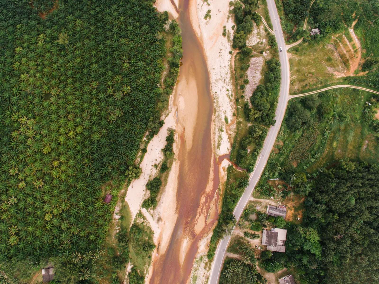
Soil and water are the first resources most farmers manage, often without calling it that. Healthy soil holds rain, feeds crops and resists wind and water; degraded soil does none of these well.
Practices that protect it are well known and mostly low-cost. Our guide to soil erosion control covers the main options in detail. The common ones are listed below.
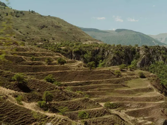
- Contour bunds and stone lines that slow runoff on slopes.
- Mulch and cover crops that keep the surface protected between harvests.
- Grass strips and hedgerows along field edges.
- Reduced tillage where it suits the soil and the household’s tools.
Water is the second half of the story. In drylands, rain often arrives in short, heavy bursts that run off before crops can use it. The techniques in rainwater harvesting for farming catch that runoff in pits, small basins, ponds or tanks so it soaks in or is stored for the dry spell.
These two topics reinforce each other. Soil with more organic matter absorbs more water, and water held in the soil keeps plants growing, which protects the soil in turn.
Grazing land deserves its own mention. Rangelands cover large parts of the continent, and their health depends on timing and movement: letting grass rest and seed, keeping corridors open and agreeing on shared water points. Rotational grazing and community-agreed reserves are the usual tools.
Wetlands, springs and river banks are another quiet priority. They filter water, store floodwater and provide dry-season pasture, yet they are often the first places drained or ploughed. Protecting a strip of vegetation along a stream is one of the cheapest ways to keep water clean.
Forests, trees and the fuel question
Forests supply timber, food, medicine, grazing and fuel, and they shelter water sources and wildlife. Rural people often manage them far better than outsiders assume, particularly when they hold clear rights to do so.
That is the idea behind community forest management, where a village or user group shares authority and benefits with the state. It works best when rules are agreed locally, enforced fairly and backed by secure tenure.
Typical rules in such systems cover where cutting is allowed, which species are protected, how fines are set and how income from forest products is shared. Written management plans help, but what matters most is that members consider the rules legitimate and see the benefits reach their households.
Trees outside forests also count. Fruit trees, fodder shrubs, windbreaks and boundary plantings provide food, shade, fuel and income, and they are often managed by individual farmers who gain directly from keeping them alive. Naturally regenerating stumps and seedlings on farms can be a cheap way to rebuild tree cover when farmers are allowed to keep them.
The causes and patterns of forest loss differ from region to region. Our overview of deforestation in africa looks at the main drivers, which commonly include agricultural expansion, wood harvesting and infrastructure.
Fuel is one of the biggest links between households and forests. Many families cook with wood or charcoal, so cutting demand and improving supply matters; see fuelwood and charcoal alternatives for stoves, fuels and woodlots that ease the pressure.
Trees also belong on farmland. Planting and keeping trees alongside crops and livestock is the subject of what is agroforestry, and the regional picture is covered in agroforestry in africa.
Managing whole landscapes and river basins
Water, soil and trees do not respect field boundaries. What a farmer does upstream affects the people downstream, which is why managers often plan around a catchment, the area that drains to one stream or river.
The approach in watershed management links upland practices such as terracing and tree cover with downstream goals such as clean water and steadier flows. It also forces different users, including farmers, herders, towns and irrigators, to talk to each other.
A basin plan often combines several steps: protecting recharge areas and headwaters, stabilising gullies, keeping buffers along streams, and agreeing how water is shared in dry months. Sharing is the hard part, because upstream and downstream users rarely have the same priorities or the same bargaining power.
Basins also cross borders. Shared rivers and lakes mean that cooperation between neighbouring countries can matter as much as what happens on any one farm, though local action remains where most of the physical work gets done.
Landscape thinking is also behind large restoration efforts. One is the African Forest Landscape Restoration Initiative, known as AFR100, which the World Resources Institute describes as a country-led effort to bring 100 million hectares of deforested and degraded landscapes into restoration by 2030, according to its AFR100 page.
The same page says its secretariat is the African Union Development Agency (AUDA-NEPAD), and that 33 African nations have signed on and committed a combined 129 million hectares. Commitments are a promise to begin restoration, not proof that it has happened, so progress on the ground is a separate question.
Restoring degraded land
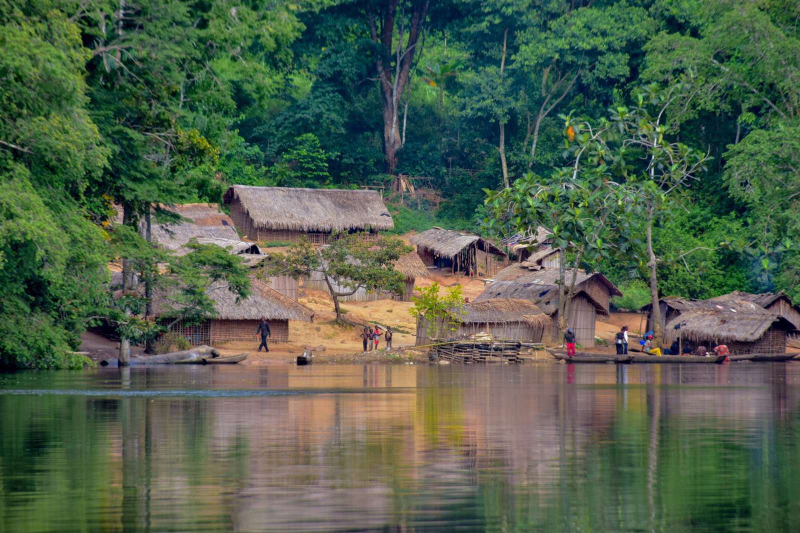
Where land is already damaged, the task shifts from protection to repair. Restoration can mean letting trees regrow naturally, planting, reshaping slopes, reviving soil with organic matter or changing grazing so grass can recover.
Our guide to land degradation restoration explains how degradation is identified and which repair methods suit which conditions. Cheaper, simpler measures that a community can maintain tend to last longer than showpiece projects.
Restoration has trade-offs. Planting trees on land that was open grassland can harm pastoral livelihoods and water supply, while fencing off land can shut out the people who used it. Good projects begin by asking who uses the land today and what they stand to gain or lose.
Survival matters more than the number of seedlings planted. A tree that is watered, protected from browsing and owned by someone who benefits is worth far more than many that die in the first dry season. Natural regeneration, where roots and seeds already in the soil are simply protected, is often the lowest-cost route.
Restoration also has a time dimension. WRI’s AFR100 page frames its goal as bringing land into restoration by 2030, which is the start of a long recovery, so monitoring has to continue well beyond the planting season.
The best-known continental symbol is the Great Green Wall. A UNCCD library page by the charity Tree Aid describes it as an African-led initiative envisaging an 8,000km mosaic of restored land across the Sahel, with the movement aiming to restore 100 million hectares by 2030, as that page states.
Large targets like these are worth reading carefully. A wall of trees was the early image, but the idea has moved toward a mosaic of farms, pastures, woodland and water points, with restoration measured in hectares of land improved rather than kilometres of planting.
Putting it together: sustainable land management
The threads above come together under the heading of sustainable land management, which combines practices for soil, water, vegetation and livestock so that production and protection support one another.
A practical way to think about a plan on any plot or landscape is as a short sequence:
- Diagnose: look for gullies, bare patches, dry springs, cleared slopes and falling yields.
- Prioritise: start where damage is spreading fastest or where a small fix protects a lot downstream.
- Agree rules: settle who does what, and who benefits, before work begins.
- Choose simple practices: pick methods people can build and maintain with local labour and materials.
- Monitor: photograph the same spots each season and record what changes.
Three conditions are worth checking in any plan. Secure rights to the land and its trees, benefits that people can see, and technical advice that fits local soils, rainfall and culture all tend to help management last.
Where those conditions are missing, even well-funded projects can fade once the funding ends. That is why so much of the field is about governance and incentives, not only about planting.
Measuring whether it is working
Simple indicators are often the most useful. Farmers and local groups can track ground cover after the rains, the depth of wells in the dry season, the number of gullies that have stopped growing, tree survival and the time taken to collect firewood.
Satellite data and national assessments, such as FAO’s forest assessments, give the wider picture, but they work best alongside local observation. Where the two disagree, it is usually worth walking the ground to find out why.
Common mistakes to avoid
- Treating a symptom, such as a gully, without addressing the runoff that causes it.
- Planting species that do not suit the site or that nobody wants.
- Skipping consultation with herders, women and other less visible users.
- Relying on outside funding with no plan for upkeep once it ends.
- Judging success by area planted rather than by what survives and who benefits.
Learning from these mistakes is part of the work. This is why checking and adjusting is one of the four parts of good management described earlier.
Frequently asked questions
What is natural resource management?
Show answer
It is the way communities, governments and landowners decide how to use and protect land, water, forests, soils and wildlife so they last. It covers both technical practices and the rules about who uses what.
How much forest does Africa lose each year?
Show answer
FAO’s 2020 assessment put Africa’s net forest loss for 2010-2020 at 3.9 million hectares per year, the largest of any region. Net loss subtracts forest gained from forest lost, so gross clearing is a different figure.
What is AFR100?
Show answer
It is a country-led initiative to bring 100 million hectares of deforested and degraded land into restoration by 2030. The World Resources Institute says 33 nations had committed a combined 129 million hectares on the page cited above.
Where should a smallholder farmer start?
Show answer
Usually with the fastest-moving problem: runoff and erosion on slopes, or a lack of stored water. Simple measures such as contour lines, mulch and trees on field edges are a common first step.
Does this site offer advice or projects?
Show answer
No. It is an independent educational site and does not sell services, take enquiries or offer consulting.